Chris Gernon

home  |  gis  |  cartography  |  projects   |  about


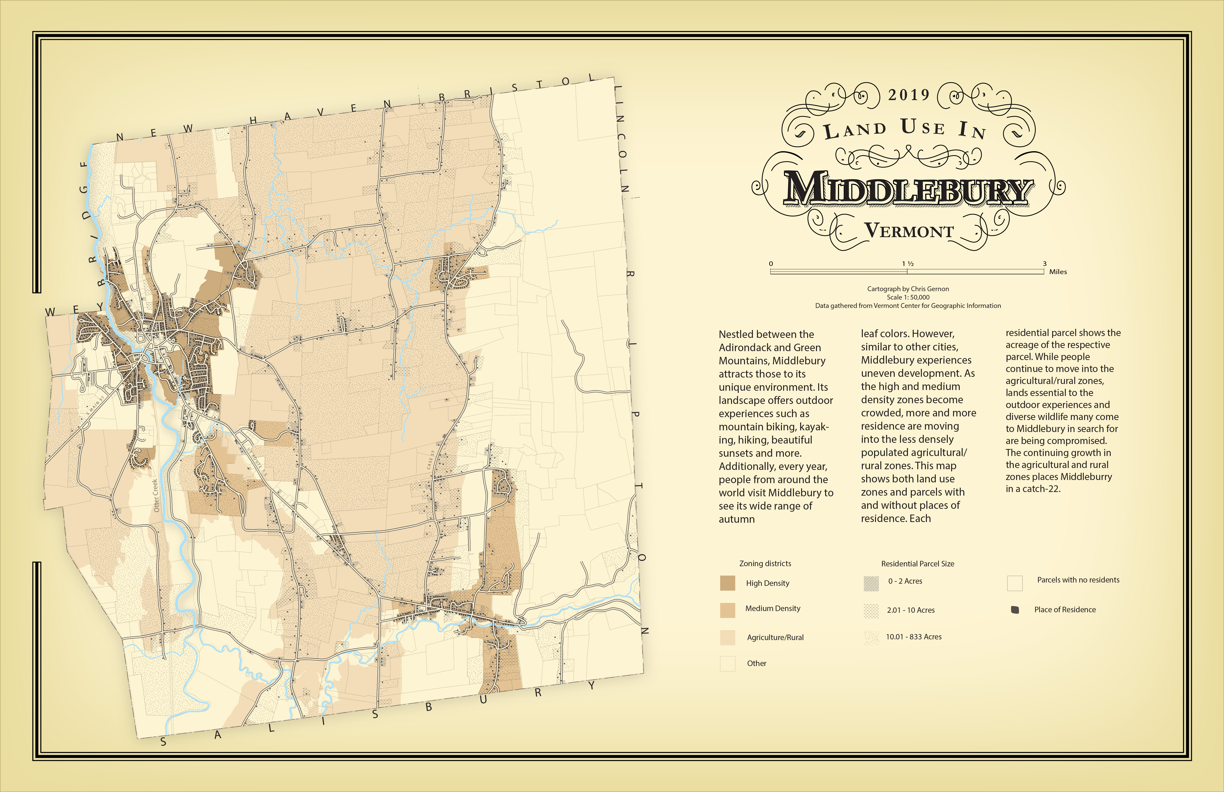
Land Use Patterns in Middlebury, VT

The goal of this project was to map the land use patterns in Middlebury that will help members of the Middlebury Conservation Commission, and potential potentially residents of Middlebury, understand current patterns of residential development in Middlebury. In addition, the map was design in the style of old-time, pre-GIS cartography. Click to see an enlarged image

GEOG 323, Fall 2019

Computer skills used: ArcGIS, Adobe Illustrator


Landcover Map

This is a landcover map of the Otter Creek Wetlands and the sourrounding area. The goal of the map was to help people understand the landcover, location and size of the wetlands, and how people may be able to access them. Click to see an enlarged image

GEOG 325, Fall 2018

Computer skills used: ArcGIS, Adobe Illustrator, Adobe Photoshop


Reference Map

This is a general reference that adopts the style of a political geography reference map from a recent National Geographic Atlas. Click to see an enlarged image

GEOG 325, Fall 2018

Computer skills used: ArcGIS, Adobe Illustrator


Is Kansas Flatter Than a (gluten free) Panacake?

The purpose of the map was to determine if Kansas is actually flatter than a pancake. In order to compare the topology the two, I took pictures of a stack of gluten free panackes and used Agisoft to stitch the pictures together in order to create a digital elevation model. I downloaded a digital elevation model of KS from the internet. Click to see an enlarged image

GEOG 325, Fall 2018

Computer Skills used: Agisoft, Adobe Photoshop, Adobe Illustrator, Batch Processing


The Timeless Continent

This map recreates Jerome Cookson's map, “The Timeless Continent” from the December 2010 issue of National Geographic. Click to see an enlarged image.


GEOG 325, Fall 2018

Computer Skills used: Adobe Illustrator